Overview - the Hardest One Day Race in the World?
ÖtillÖ claims to be one of the most difficult one day races in the world, and at first glance, one can understand why - just from the distances alone. Further investigation reveals how one actually participates: fully decked in a wetsuit, usually altered - with the legs cut off at the knees, running shoes, and a backpack - to carry supplies - all of which make many races pale in comparison. Then consider (1) the environment in which the event is held: in the Swedish archipelago and the Baltic Sea, (2) the terrain: 19 rugged islands (some inhabited, some not), (3) the distance: 54 km running and 10 km swimming and (4) the water temperature: between 10 and 16 degrees Celsius (50 – 60 degrees Fahrenheit). The combination of all these factors makes for a challenging race well before the start gun has even gone off.

As you can probably imagine, if you’ve never competed in this race, chances are you’ve never done anything like it before, which places you at distinct advantage to those who have previously competed in ÖtillÖ. To further complicate matters, I was in London and Adrian, my teammate, in New York, so training together was not going to be possible. However, we had previously swum in the same Masters class while I was in New York, I knew Adrian was (still is) a very gifted athlete. So, through loose communication, we did manage to follow a similar training / preparation regiment, and we were confident that despite our geographical isolation we’d be ok racing with each other on what was to be the longest race either of us had done by a margin of over 5 hours.
Given Adrian’s strength in swimming (he was close to an Olympic level swimmer back in the day) and both of our running abilities, we thought we had a decent chance at finishing on the podium, but in a race like this (especially when neither participant has done this race), anything can happen over the span of 64 km and 10+ hours.
So here we go....
Day 1 – Road to Saltsjöbaden
My day started in London, and my mom, who was over to watch the race, were due to depart Heathrow for Stockholm - Arlanda at 11:30 a.m. on British Airways. After a smooth trip out to Heathrow, we arrived at our gate and boarded the plane for Sweden.
The 2.5 hour / 908 mile flight went by quickly, and 30 minutes from touchdown, the plane began its descent. As we neared the ground, we could clearly see, unsurprisingly, the landscape had completely transformed from England’s melancholy rolling, green hills to a landscape riddled with lakes, the Swedish red, timber farmhouses and evergreen trees stretching to the horizon. On the approach, the intricate web of sea inlets (Stockholm itself sits on 14 different islands) dotted with sailboats came into view, and shortly, thereafter we had arrived in Sweden.
To me, the Nordic atmosphere was noticeable as soon as we exited the jet way into the main terminal as the floors were wooden and the design, probably deliberate, was what you’d picture walking through IKEA. Once we worked out where the yellow, high speed Arlanda Express was, we purchased our tickets, which were very expensive (even compared to the Heathrow Express) – welcome to Scandanavia, boarded the 20 minute train to Stockholm centre and were off. Some of the small things I noticed on the way in: (1) Volvos, which are manufactured in Gothenburg, Sweden, and Saabs, which are produced in Trollhättan, Sweden, make up probably 40% (slight exaggeration) of the cars, (2) loads of blond people and (3) the little red cottages are EVERYWHERE.
The plan for the day was to take the Arlanda Express to Stockholm Central station, and from there, take a train to Saltsjöbaden, which is approximately 30 minutes outside Stockholm on the edge of the archipelago and would be where I’d meet up with Adrian and several others racing ÖtillÖ. Of course, much easier said than done.
When we arrived at the central station, it was immediately apparent that it wasn’t going to be a straightforward transfer to the Saltsjobaden train as the board announcing departures and corresponding platforms was devoid of any reference to Saltsjobaden. So, I tried using one of the information kiosk computers to figure out which train we were supposed to catch, but after changing the language from Swedish to English and running a search, all the results came back in Swedish. Needless to say, this was a dead end.
So, we finally acquiesced and decided to ask for help. Being in Sweden, I thought getting help, in English, was going to be very easy. Turns out, we had to speak to three people before we found someone who spoke English. Maybe they didn't feel like talking to tourists...it worked. After grossly mispronouncing Saltsjobaden (i.e. at first, they had no clue as to which town I was talking about), a lady offered to help. Unfortunately, the directions we were given were not clear at all – only another place was mentioned – Slussen. Eventually we realised we needed to take the Tunnelbana, the Stockholm metro, to Slussen station and take the commuter train to Saltsjobaden.
Sure enough, we caught the Tunnelbana to Slussen, as soon as we exited the train we saw signs for Saltsjobaden. All in all it took us over an hour from our arrival in Stockholm Central to get to where we currently stood – all of which should have taken 15 minutes. The train looked very different from what I expected – which was sleek, modern and efficient. However, the sight before us couldn’t have been more the opposite. Blue, probably 40 years old, retro-clothed seats and what you’d expect to board on a trip in the middle of Siberia, but...it ended up being a very cool commute.
The train ride proved to be a very casual crawl along Stockholm’s harbour, then through the verdant suburbs, frequently crossing bike paths and local schoolyards. With the windows open and being a comfortable 15 degrees C (c. 60 degrees F), the 18 km journey was refreshing. We could tell we were closing in on the coast as we passed numerous pods of sailboats tied to their moorings just offshore from the ubiquitous red cottages dotting the rocky coastline, and shortly afterwards, we arrived at the end of the line.

The Grand Hotel, our residence for the night, is located right on the sea and 200 meters from the end of the line. It's an impressive building in the otherwise quaint town seaside village, and the views of the surrounding harbour and sheltered cove are really nice / serene. The building was built in the 1800's and has been used to host Swedish royal events although I'm pretty sure such events were held a long time ago as the building is showing signs of age. But, the location is spectacular. Our hotel room was probably one of the best in the entire place as we had a corner room with 4 large French doors facing out to the harbour below, so the trip had definitely begun on a positive note.
Once we checked into the hotel, I met up with Adrian to catch up and begin disussing our tactics for the race. I also wanted to jump in the water to get a feel for the temperature as this had become my biggest concern, especially given the coldest water I'd swam (for a material amount of time) in was about 17 degrees. As I previously mentioned, the sea temperature in the archipelago ranges from 10 - 16 degrees, and when your body has been going for 8 hours, it can struggle to maintain a safe core temperature - hence my nervousness. So, Adrian and I walked out around a small island in front of the hotel and I found a good place to jump in. With the wetsuit on, I slowly slid down the slippery rocks into the Baltic. As the water entered the wetsuit and my face hit the water, there was definitely a bit of a jolt, but not the pain which usually accompanies really cold water. But the more bizarre discovery was the salinity of the sea.
Usually, when you jump into the ocean, you can taste and feel the salt; however, here, there was only a very faint trace of salt - so faint, there was a negligible increase in buoancy - like swimming in a large freshwater lake. So, I did and little research and sure enough "low salinities occur in polar seas where the salt water is diluted by melting ice and continued precipitation. The Baltic Sea ranges in salinity from about 5 to 15 o/oo (or parts per thousand)" whereas "the salinity of the ocean water off Miami Beach, Fla., varies from about 34.8 o/oo in October to 36.4 o/oo in May and June." Furthermore, "the salt content of the open oceans, free from land influences, is rarely less than 33 o/oo and seldom more than 38 o/oo." So based on the above, the water we were swimming in was very unique compared to most oceans in the world. So unique I was told, that if absolutely necessary, one could drink the sea water and hydrate themselve. Interesting stuff....
Anyway, I swam out into the clear, dark blue sea under the setting sun, and, as I continued out, my body became accostomed to the cold and began to relax. Wow....what a great feeling - being out in the crisp, blue Baltic, under a beautiful Scandanavian sky, and with stunning terrain in every direction. From that point on, I knew that ÖtillÖ was going to be epic.
That night we ate at the hotel's harbourside restaurant, and I'll have to say the waitstaff serving our section lived up to the Swedish stereotype. Wow.
After a steak dinner and a few glasses of wine, I was beat and didn't last long. The following day was going to be a long one - race preparation, transfer to Sandhamm - starting point of the race and team check-in.
Day 2 – Off We Go - Sandhamm
After an early wake up and breakfast, Adrian and I met up to make sure we had all the mandatory gear (ÖtillÖ requires madatory items like compass, medical bandages, GPS, etc) as well as our personal gear. Since it was our first time doing this race, a substantial amount of our preparation was guess work based on our SWICK experience (instead of triathlon BRICK - bike then run workout - ÖtillÖ training is a SWICK - swim - run). My training had been in the Thames near Oxford and Adrian's in the Hamptons. Both far cries from the Swedish Archipelago.
ÖtillÖ is a tricky race to prepare for given the participants run in wetsuits, have to bring fluids and nutrition for the distances between the feed stations, and the fact there are no specific rules prohibiting swim aid equipment (other than motorized devices - i.e. fins, paddles, buoys and even rafts are permitted). So then the question becomes, do we want to go light and fast, which means you'll reduce drag in the water by using a small waist pack or backpack, or safely prepared, which may mean a large backpack with plenty of supplies, maybe fins, and paddles
. How much drag you create is a critical decision in this race owing to the amount of time spent in the water. Swimming 10 kilometers alone is a daunting task, and swimming 10 kilometers while running 55 kilometers makes the task almost scary with the cumulative exhaustion (from swimming, running, entering and exiting the water, climbing up the rocks, etc.).
Another consideration is the 38 “transitions” or “ins and outs” between the 19 islands. Speed is key because taking a minute longer, which is small on its own, than your competition will cost you almost 40 minutes, which is a large gap. So with that in mind, Adrian and I opted for the light and fast approach mainly to avoid creating too much drag in the water, and we figured with aid stations every hour we'd be ok with a small water bottle and 5 or 6 gels (along with the mandatory gear).
After running through our strategy and discussing the race course and map, we went through our gear checklist, which was the following:
- wetsuit - below the knee cut off to allow for better flexibilty when running
- neoprene cap - we figured this would be helpful later on in the race when our bodies were struggling to keep warm from the exhaustion. Plus the water is cold anyway...
- neoprene gloves - rationale similar to the neoprene cap
- waist pack - for each one us - these would carry our gels, mandatory gear, inlcuding map waterproof phone, and one 3 oz water bottle
- swimming paddles - small
- compression socks
- shoes - which are kept on the whole race (i.e. swam in)
- vaseline - lots of it to reduce chaffing
Once we had made sure we had all the right gear, it was time to grab our stuff and head out to Saltsjobaden's ferry dock to catch the ÖtillÖ ferry, which left at 12:30, out to Sandhamm. We decided to grab a quick bite at the local cafe (the vegatable lasanga was amazing!), and subsequently followed the trickling of ÖtillÖ athletes to the ferry. When we arrived at the dock, the ÖtillÖ staff were there to greet everyone and welcome them to the race as the boat was specifically reserved for the 160 ÖtillÖ participants which was pretty cool. Our friends and family would stay in the Grand Hotel one more night, and a pre-arranged boat was to pick them up the next morning to follow and spectate the race. So, the boat was loaded with tough looking Scandanavian types and tons of duffel bags, and you could sense the anxiety hovering in the air. With the main cabin full, our group headed to the roof for the one hour and forty five minute journey out to Sandhamm.

The day was perfect - sunny with a breeze blowing off the sea. As we cruised out into the channel, we were able to more clearly see the challenging terrain we were to encounter the next day. The islands and their beaches are rocky with dense vegetation, and at some places, the crest of the island was 20 or 30 meters above the sea - not exactly flat or a straightforward crossing. The scenery was really amazing. There were also sailboats everywhere, and when I made the comment about the number, someone said that Stockholm alone had over 750,000 boat registrations alone (with a population of just under 1.2 million). Although I can't verify that number,
Sweden does have one of the highest numbers of boats per capita in the world.
About an hour out from the harbor, we could see some of the islands we'd be crossing. Some up to 10 miles long others only 200m. All beautiful but to be running across and swimming in between them was going to be another story. We'll would soon find out.
After about an hour and forty five minutes on the ferry, we arrived at Sandhamm, a sma
ll, natural port in the archipelago with easy access to the Stockholm. Sandhamn has been popular for boating since the late 19th century. It is known for its tavern, its clubhouse, and, not the least, its harbour, which was very picturesque. The ferry docked, and all 180 or so people exited the boat on the way to race preparation area to gather race bibs, GPS, waterproof cellphones, have equipment checked, grab hotel key, etc. etc. The ÖtillÖ race had essentially taken over this small town of 108 people. The one hotel, which is very, very cool, was completely filled with ÖtillÖ athletes.
The next activity for the day was to run out to the first swim, get a little practice in, and run back in time for the race briefing at 5:30 p.m. So, after grabbing all our gear, checking in, we slipped on the wetsuit, shoes and ran out to the first swim, which was the longest of the race 1600m, to just get a feel for water. It was fantastic! Run out and the water felt great - the first swim was across a large channel and while swimming we saw cruise ships and huge fishing vessels passing through as we swam out - very cool to see.

By the 5:30, everyone had gathered in the Sandhamm hotel's restaurant / bar area, which was in a large atrium overlooking the harbour outside adorned with all kinds of fishing memorabilia, for the official race briefing from the two guys in charge of running the race - Mats Andersson and Michael Lemmel. To begin the race overview, they prefaced with the history of the race, which, as with many similar ultra-distance races, began as a drunken bet. Apparently four guys, who still race ÖtillÖ every year made a bet that they could not make the passage from Uto to Sandhamm - period. However, a pair did - in about 36 hours - sleeping on mosquito infested islands (which we would experience the following day!) - asking island residents for food and water - and risking being overrun by boats during the 19 swims....a much more daunting task given no trail markings or race officials controlling boat traffic.
Once the race briefing ended, the athletes were treated to a massive dinner, which was definitely needed. We scarfed down several plates of the delicious pasta and spoke to several of the other athletes at our table - most of which had already participated in the race. Once dinner concluded, I decided to grab a few beers with my English training partners, and shortly thereafter, headed back to the room to put together the final race preparations and get to bed as the race was to start at 6 a.m. the following day with breakfast at 5 a.m.
Day 3 – Race Day
The day had finally arrived....this had been the moment we'd been preparing for over 6 months with intense, long training sessions, but I couldn't wait to get started and actually see what this race was all about.
Adrian and I were out of bed at 4:30 to for breakfast....put down a load of calories, went back to the room, I covered myself in vasoline (to prevent chaffing), suited up and off we went to the staging area. Upon exiting the front of the Sandhamm hotel, we entered a sea of neoprene and jittery conversations. The sky was coloured with deep oranges and reds with the imminent arrival of the sun in the south-eastern sky, and with about 5 minutes to go, we all were moved to the starting straight.

With a final, brief "good luck" and "enjoy the race," the race was about to begin. As we entered the final minute before the race, a filming helicopter appeared over the harbour, and BOOM....we were off...for a LONG day.
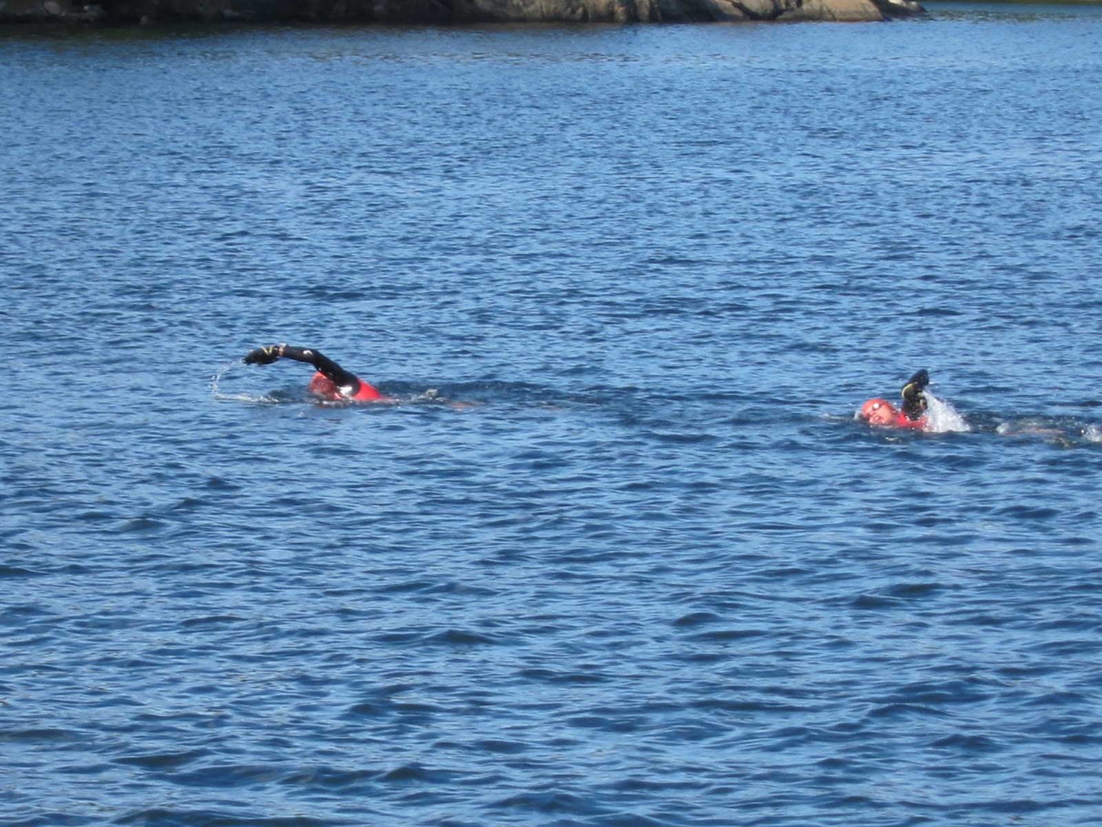
As with almost all races, the beginning starts off at a lightening pace and this one was no different. For the first mile, which is the distance to the first swim, we clocked about a 6:30 pace (per mile), but once the first and longest swim of the day started, the field began to spread and the pace slowed.
After about a 25 minute crossing of the channel, Adrian and I arrived at the first exit, which, as we had been told, was (as with the remaining 18 exits) not exactly a straightforward process. With paddles on your hands / cold water and algae covered rocks, extracting yourself from the water was a delicate, tricky process, and the movements / positioning required were slightly concerning as these were exactly the kinds which are prone to cramping, especially in the latter portions of the race. So, with that being said, once we reached the first island, the swim exit was a morass of flailing arms, unstable, contorted athletes attempting to wrench themselves from the 14 degree sea. After falling on my face a few times, I managed to crawl out of the water for the first run of the day.

This was going to be interesting part for me as the race description stated the island crossings were "trail runs," but we'd heard from other athletes who'd participated in the race, most of the time spent on the islands would be on unwieldy, ankle breaking trails strewn with loose rocks, covered in slippery moss, fallen trees, dense vegetation and large slabs of rock. The first island crossing was only a glimpse of what was to come later in the race. It was up and down rocky outcroppings, jumping from ledge to ledge, slithering under fallen trees, and dodging whipping branches...all of which expended far more energy than the usual trail run. But hey.....it was fun as hell and definitely an exhilarating experience, especially with the helicopter hovering overhead.
As the race progressed and the drone of the helicopter faded, the field eventually would spread to almost 8 miles, especially given that some athletes were not expected to cross the finish line until 9 p.m. that night with the winning team crossing about 3 p.m.. For the first four hours, Adrian and I kept a solid pace and were in the first 10 teams, and we were both feeling strong - making sure we adequately refuelled at the aid stations (i.e. pounding Red Bull, eating cinnamon buns, hot dogs to even drinking cup after cup of beef bullion - probably the best thing on the entire course since your body is completely depleted of salt). Runs felt steady and the swims were actually a refreshing cool down from the long, 1 hr+ runs; however, this would change in the latter half of the race.
At around the 4 1/2 hour mark, Adrian started to feel pain high in his upper quadracep and had to slow down to prevent further aggravation, but we still managed to hold decent pace. However, with each additional step / ascent / decent of a rock outcropping, the pain worsened to a point where our island crossings were done at a walk. But, we were still moving....

At this point, our "race" ended (i.e. Adrian and I wanted to try and podium the race), but we were going to do all we could to ensure that we finished the race. Fortunately, we had made significant progress in the first 5 1/2 hours as evidenced by the fact that other athletes trickled by us for the next 7 hours - right up to the finish line on Utö. So, we slowly walked the remainder of the race, and given that I felt ok (tired yes but not in excruciating pain), I was able to take in the stunning scenery of the course - dotted with red cottages, green fields, beautiful forests, rocky coastlines and stunning views of the ever present Baltic sea with the downside being the cold water slowly began to take its toll on our bodies. Since we weren't heating ourselves up on the runs (i.e. were walking), the cumulative effect of the cold water and muscle fatigue began to really wear us down towards the final hours. The cold water over our legs, which were filled with lactic acid, made each water exit and the island crossings more painful not to mention making our body temperature drop to a point in which we were shivering.
But the end was in sight....after 5 hours of an honest push and 8 hours of a slog towards the finish line. With the deepening shadows and sun approaching the horizon, we reached Utö, the final island. We had been giving a small taste of the encroaching mosquitoes on the previous island crossings, but on Utö, we were absolutely swarmed. Since our pace was at a walk, we were a welcome target for the bloodsuckers. Shit - I hate mosquitoes, and we were eaten alive for the last 2500 meters. The finish line could not appear fast enough.
Finally, after 30 minutes, the end was in sight, and shortly thereafter, we reached the end. What a day! Exhausted, hungry and ready to get the damn wetsuit off....we briefly spoke to our friends and family and quickly retired to the hotel room to shower and to get ready for the closing ceremonies / feast, which were fantastic...although, I could barely keep my eyes open after dinner.
The next 24 hours were spent feeling like I had been beaten with a baseball bat...but in a good way. Love the feeling...of accomplishment.
Day 4 – Stockholm and Return
Today was spent slowly making our way back to London by starting at Utö, 1 1/2 ferry to Saltsjobaden, train from Saltsjobaden to Stockholm, quick tour of Sweden's capital, and flight back to London. All walking done with a limp.
What a trip....
 Day 1
Day 1
 About 30 minutes from Chanrion, I decided to stop and make camp under the gaze of two ibex perched on the edge of a buttress, and with the sun disappearing behind Grand Combin towering above, I settled in for a cold but peaceful night and with an absolutely stunning view of a star littered sky.
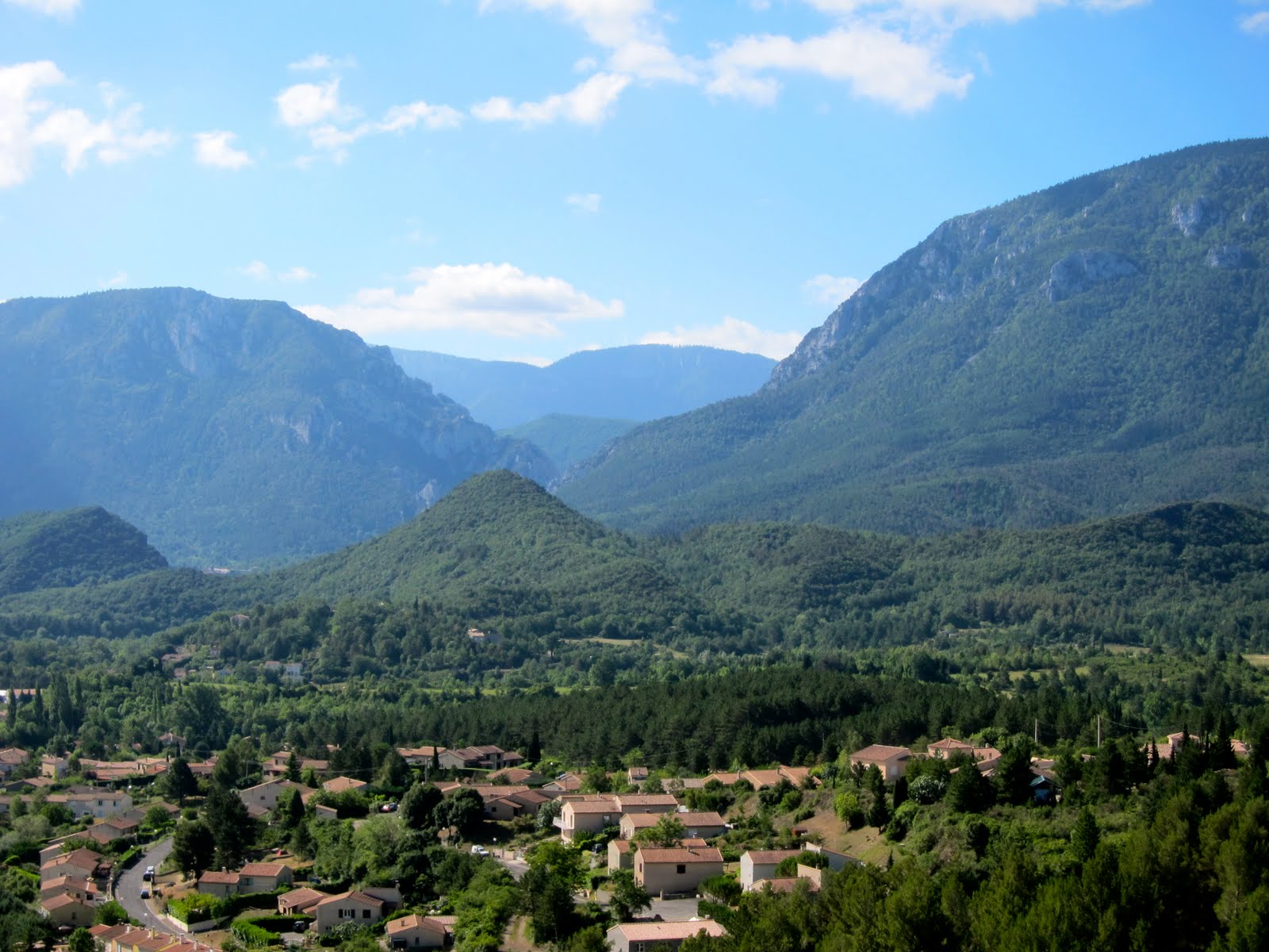
 The route was a really nice with spectacular views of the Rhone valley and the Grand Combin massif. Although some of the slab sections made your palms really sweat owning to the 150 - 200 meter drops below.
 Anyway, we all ended up having an absolute blast at the club in Zurich and made it an 9 p.m. - 5 a.m. affair...shockingly the Swiss put on a kick ass Halloween bash. Had the best time...and met so many interesting people with the most diverse backgrounds. Would definitely go back again...